LYCIAN WAY
Lycian Way
The ancient region of Lycia is now famous for walking, hiking, and trekking. The establishment of the Lycian Way, Turkey’s first long-distance footpath was set up during the nineties by Kate Clow an ex-pat residing in Antalya. The project won a conservation competition set up by the Garanti Bankasi and part of the prize was sponsoring the implementation of the route. Today people arrive from all over the world to hike the trail either independently or as part of a package tour, bringing a boost to alternative tourism and local village economy.
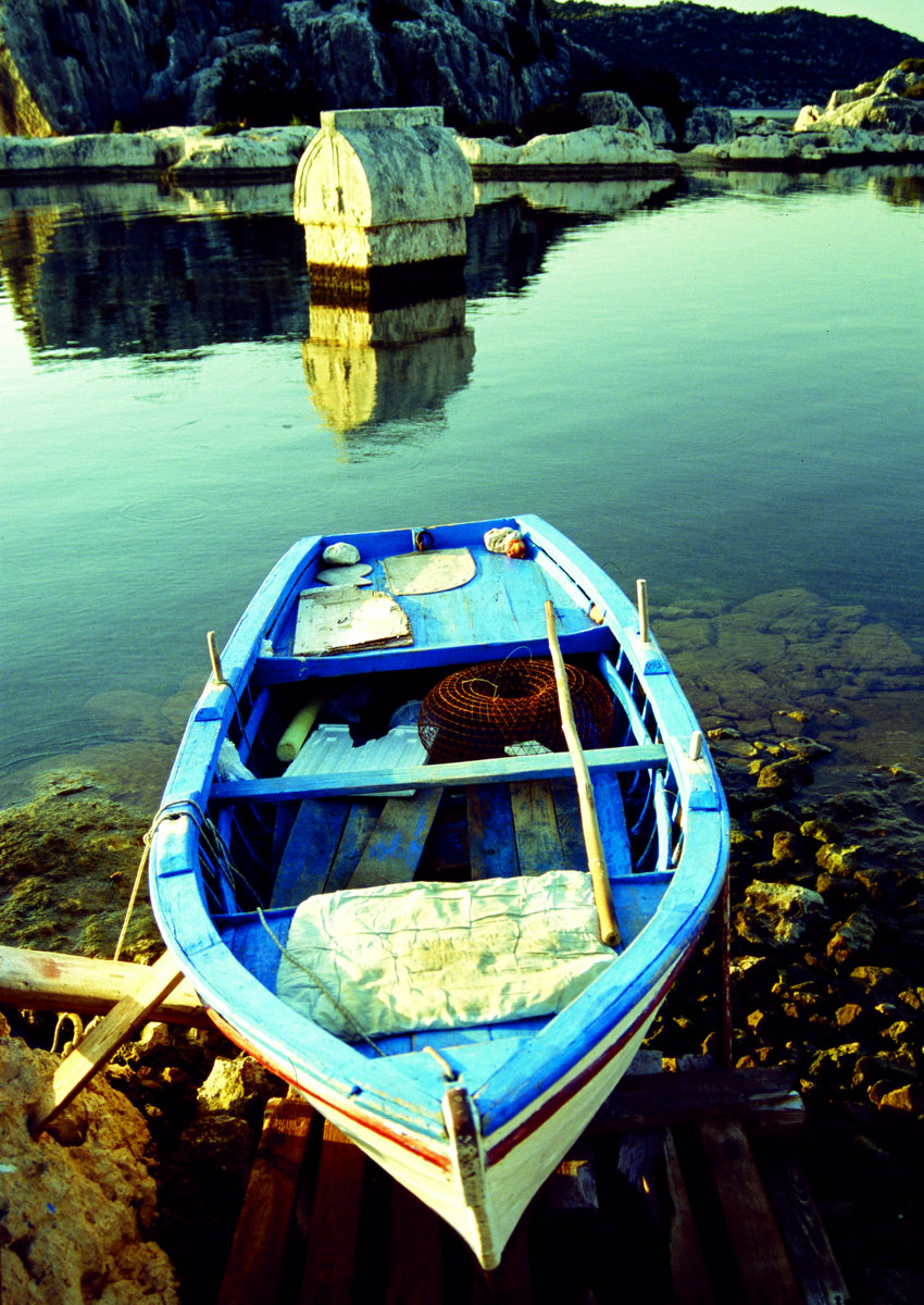
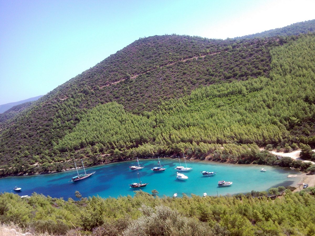
Geographically, Lycia is a walker’s paradise with the limestone peaks of the Taurus Mountains sweeping down to a rugged shore of forested capes and secluded coves. Warm turquoise waters invite the intrepid trekker along coastal paths and ruins of ancient empires glorify the spectacular landscape. Snowmelt gushes down narrow defiles to irrigate fertile plains and grazing goatherds define a biblical scene. Rock hewn paths connect forgotten cities and shepherd trails ascend to the ‘yayla’ summer pastures hidden amongst the mountain scree. Whether one wants to stroll through a meadow coloured with red poppies or climb a ten thousand foot summit in snow and ice, Lycia has it all.
When to come?
Guides and articles on the region and writers seem to be specific about times of the year, yet none have mentioned the winter months. With three hundred days of guaranteed sunshine, apart from midsummer, Lycia is ideal for outdoor activities. The wildflowers start to bloom in January with purple and white anemones’ splashing the coastal hills with colour, ‘nergiz’ narcissus carries a perfumed fragrance and mandrake leaves form a flat rosette centered by silvery violet flowers. Lycia translates to the land of lights or illuminated land and winter sees the brightness exposed in every photograph. Apollo, a god of light from Greek mythology was Lycia’s most worshipped deity and one legend tells that Leto gave birth to the twins: Apollo and Artemis in the region. The site of Letoon pays homage with its three temple bases to the ancient gods.
Unique to the area is the richness of ancient history, with over seventy sites in the Lycian region alone, walking has always been the best way to explore and discover the wealth of nature the regions landscapes have to offer.
Specifically for walking, we recommend ‘The Lycian Way’ guide by Kate Clow, three Sunflower Books cover Bodrum to Antalya with new walks by Dean Livesley. ‘Walking and Birdwatching’ in South West Turkey by Paul Hope also covers botanical notes.
You can find the further Information about Lycian Way on the webpages: cultureroutesinturkey.com, www.lycianway.com and www.trekkinginturkey.com
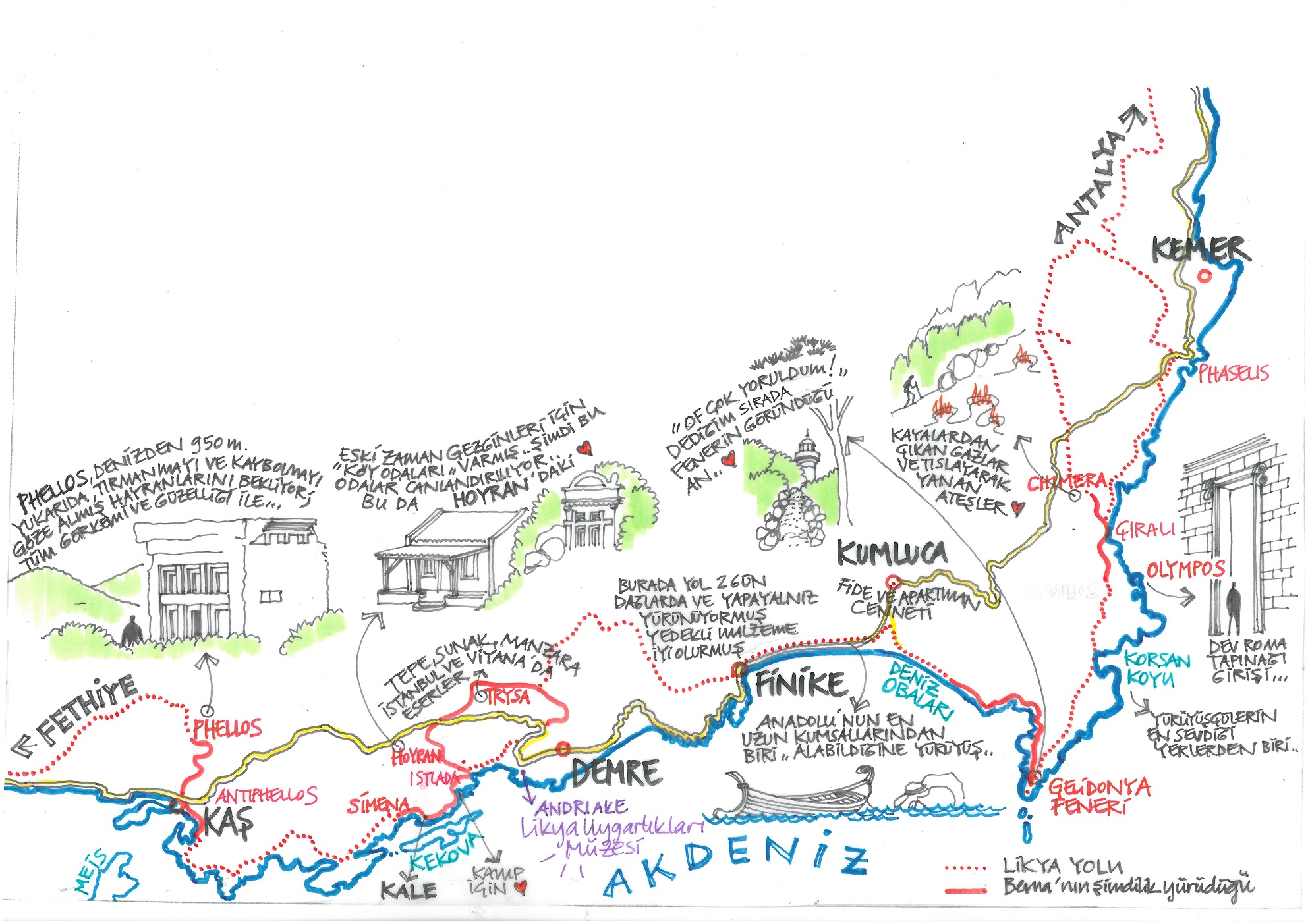
Walk 1: Hoyran Ancient City
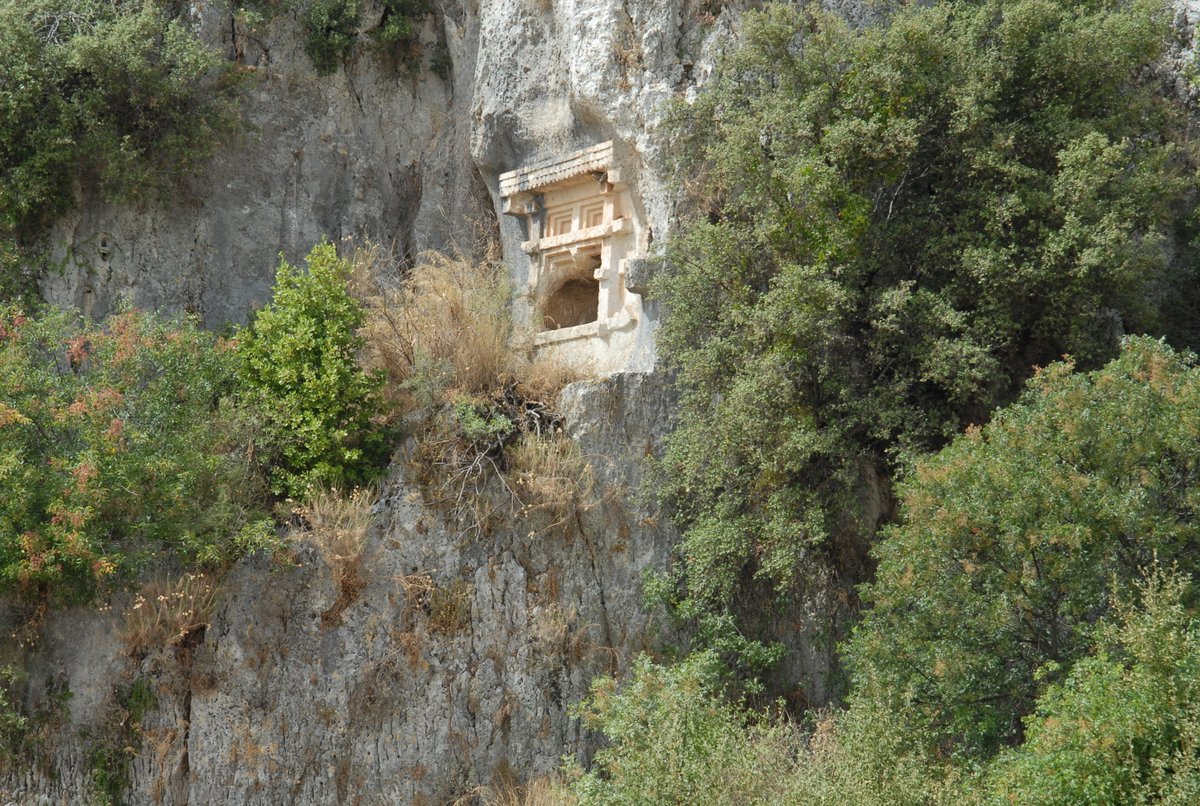
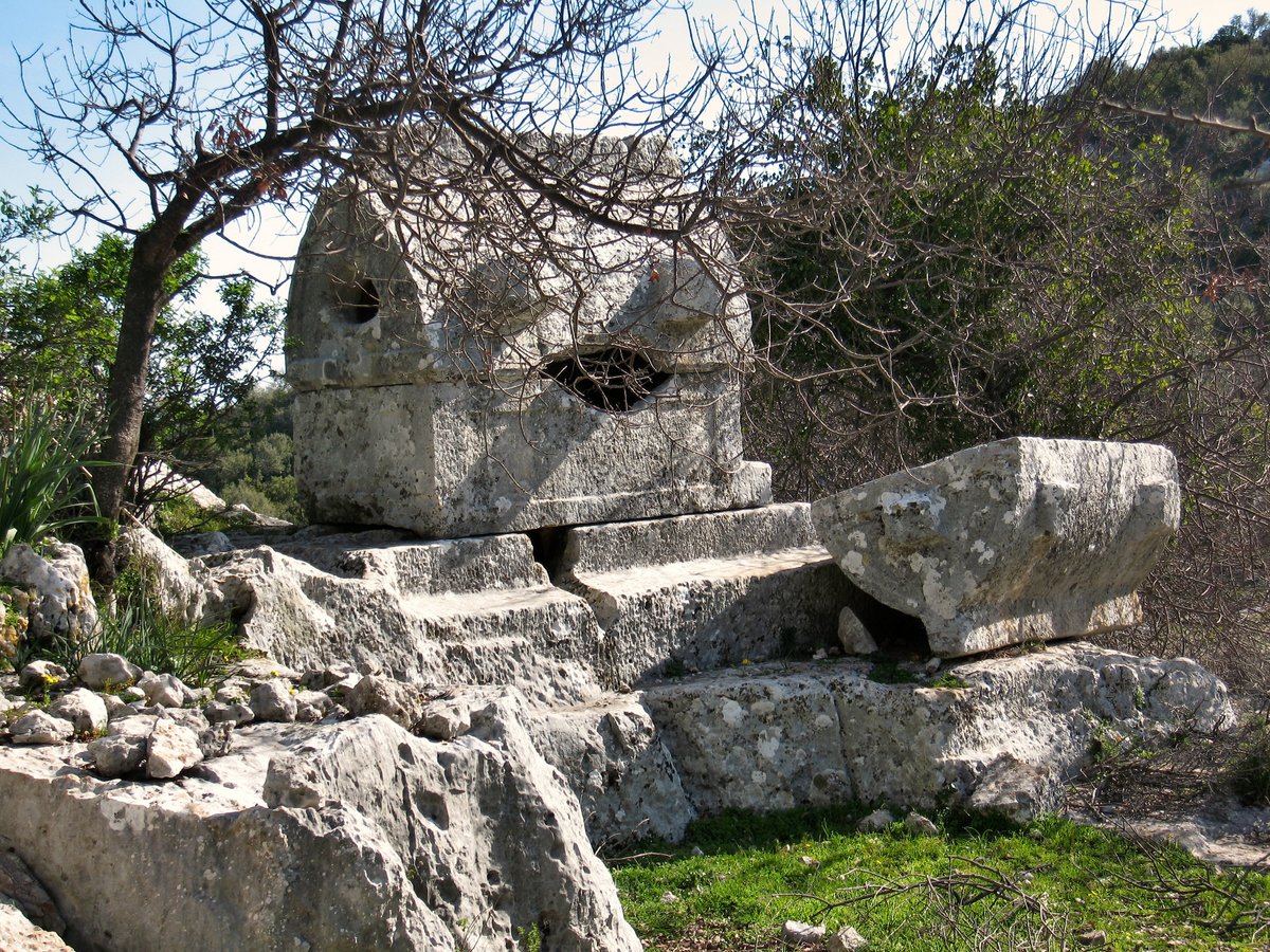
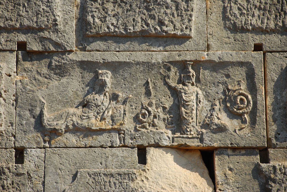
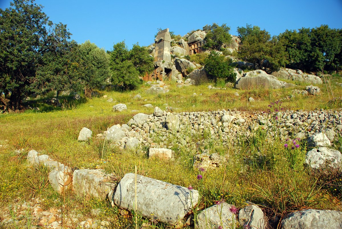
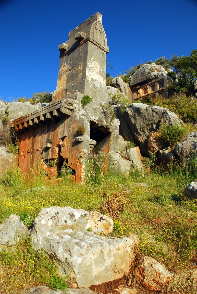
At the end of the village, you’ll find a walled path before crossing a stile across a terraced land to a cliff. The path leads up the small cliff passing through tombs to an open area. Behind the pillar tomb are Lycian rock tombs, one adorned with partridge cockerel, and a griffon, the other has a relief of the family paying respects to the seated figure.
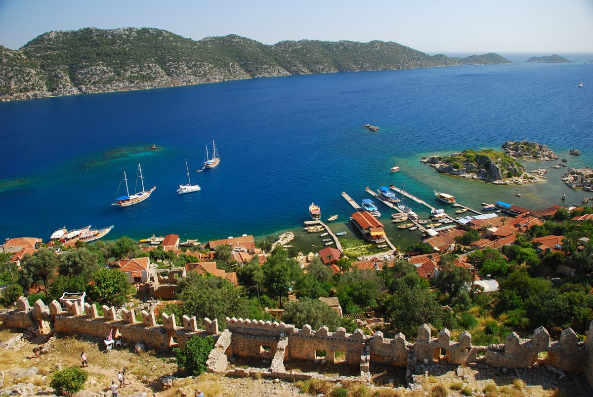
Up and through the gap between rocks brings one to a delightful picnic terrace with a spectacular view over Kekova Island. This is one of the favourite camp locations of walkers, but as Hoyran is better known these days it is no longer a secret location.
Walk 2: Kyaneai – Hoyran
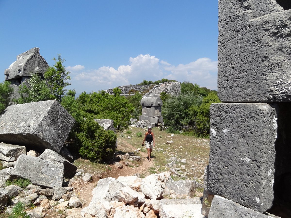
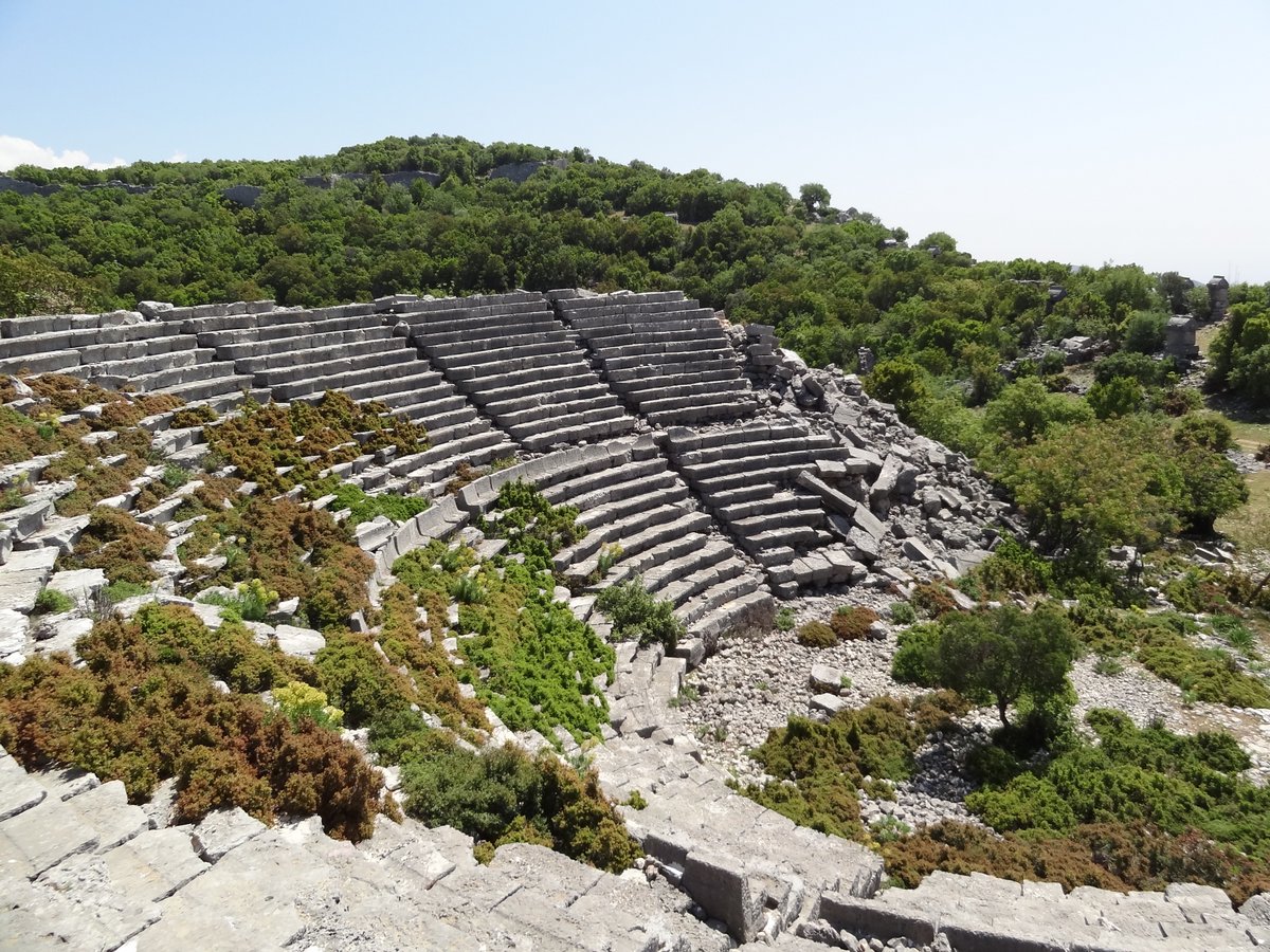
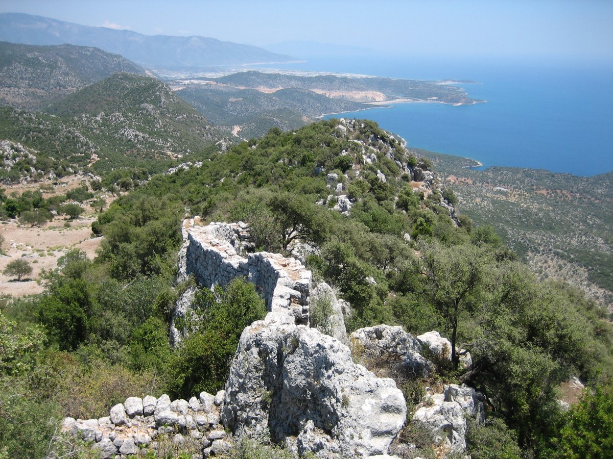
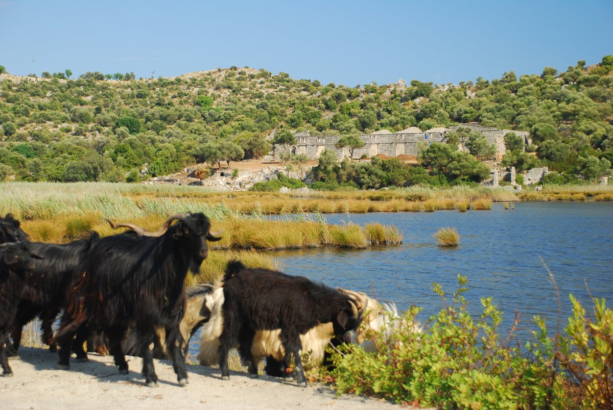
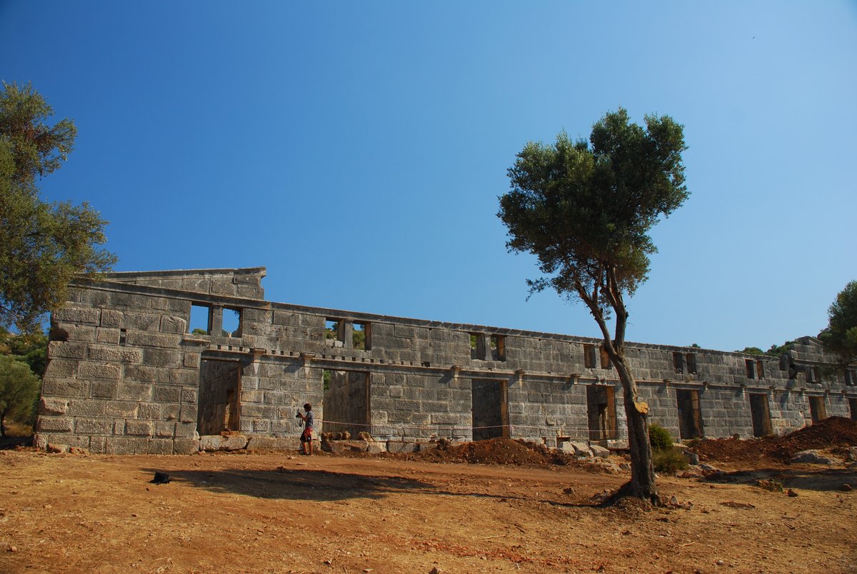
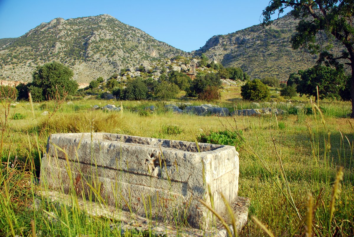
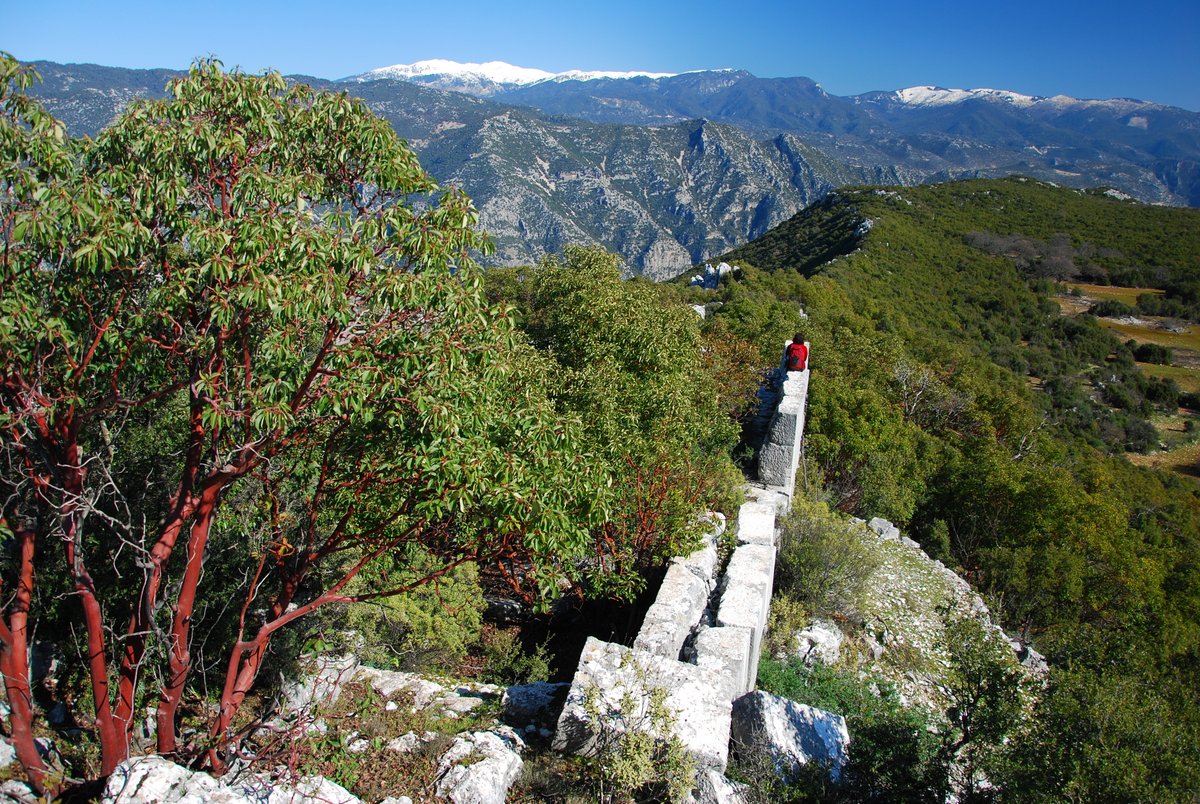
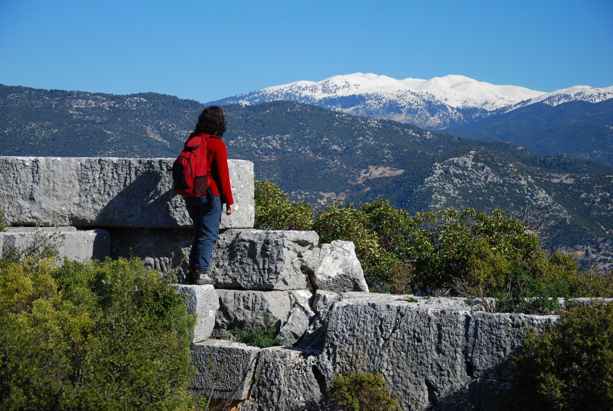
The walk starts from the main Antalya highway before descending into the Yavu plain traveling from the Kas direction. Following a dirt road inland the track leads up to a small hamlet consisting of a few old stone houses and mature shady oak trees. The rocky track continues up the hillside (driveable but preferably not in your own car). Forking right the track leads up to a flat open area passing the citadel walls above. Numerous sarcophagi, buried cisterns, and theatre stand eerily in the silence broken only by the distant sound of goat bells.
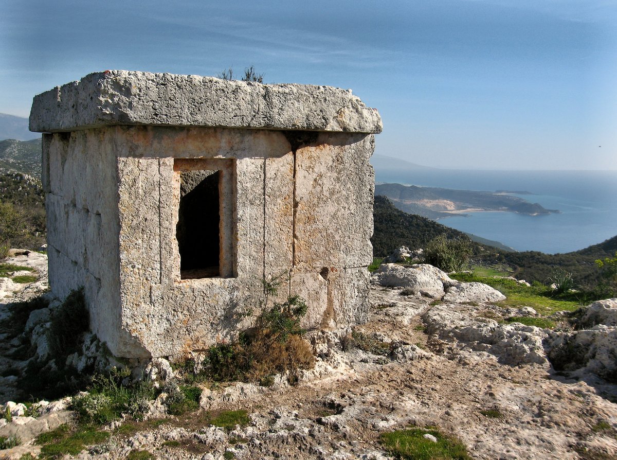
Following a path upwards between tombs shows the defensive position rising high above the Yavu plain, below in the cliff is a temple style tomb viewed from the road.
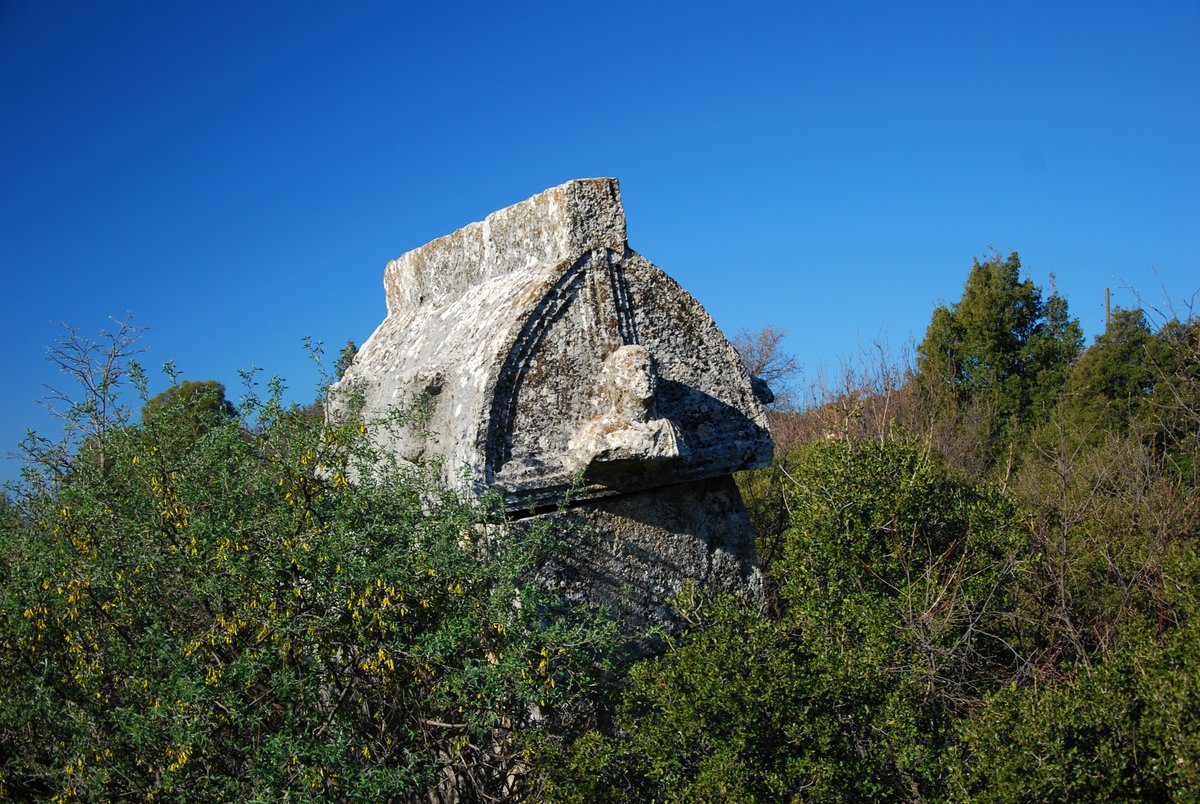
The citadel wall is very impressive intact on three sides protecting many ruined buildings. Vaulted underground chambers and cisterns were used to store grain as well as water dot the area. Kyaneai boasts so many tombs in different style: some Lycian, others belonging to Hellenistic and Roman periods. The views on the northern side look across to the snow-clad ‘Akdag’, ‘Susuz Dag’ and ‘Alacadag’ peaks of the Taurus Mountains.
Descending from the eastern side one picks up the path descending by a gulley down to the village of Yavu. The path passes an impressive stone inscribed in three columns telling the exploits of Jason of Kyaneai, the city's most famous citizen.
Cutting across farmed fields one crosses the main highway picking up a dirt road heading towards the sea. The route runs past cultivated fields before ascending round the hill, descending slightly turn left at the next junction. The track runs through rugged limestone and maki with lush meadows full of wildflowers. Cultivated areas grow wheat and barley or oregano which also grows wild in the rocky landscape. The track passes old stone houses and cisterns at ‘Kizilovacik’ Red hollow and undulates through small valleys to the village of Hoyran. At the end of the village follow a walled path before crossing a stile across terraced land to a cliff. The path leads up the small cliff passing tombs to an open area. Behind the pillar tomb are Lycian rock tombs, one adorned with Patridge, cockerel, and griffon the other has a relief of the family paying respects to the seated figure.
Up and through the gap between rocks brings one to a delightful picnic terrace with a spectacular view over Kekova Island. Returning to the village the road leads past ‘Hoyran Wedre’. (5hrs)
Walk 3: Hoyran- Kapakli- Andriake (Cayagzi)
A new dirt road leads down beside ‘Hoyran Wedre’, the marked path runs off the road tracing the ancient Roman trail zig-zagging down the hillside. Passing by the mosque through the village of Kapakli the road descends seawards onto the path and joins into the ‘Lycian Way’ long-distance walking path. The path cuts through rocky terrain before descending to the coast. The water is always so inviting so don’t forget to carry your swim kit and towel.
The route continues ascending from the shore past shepherds dwellings before dropping to the mountain fresh stream at ‘Cayagzi’ Rivermouth. The last obstacle to reach the beach is a rickety old bridge.
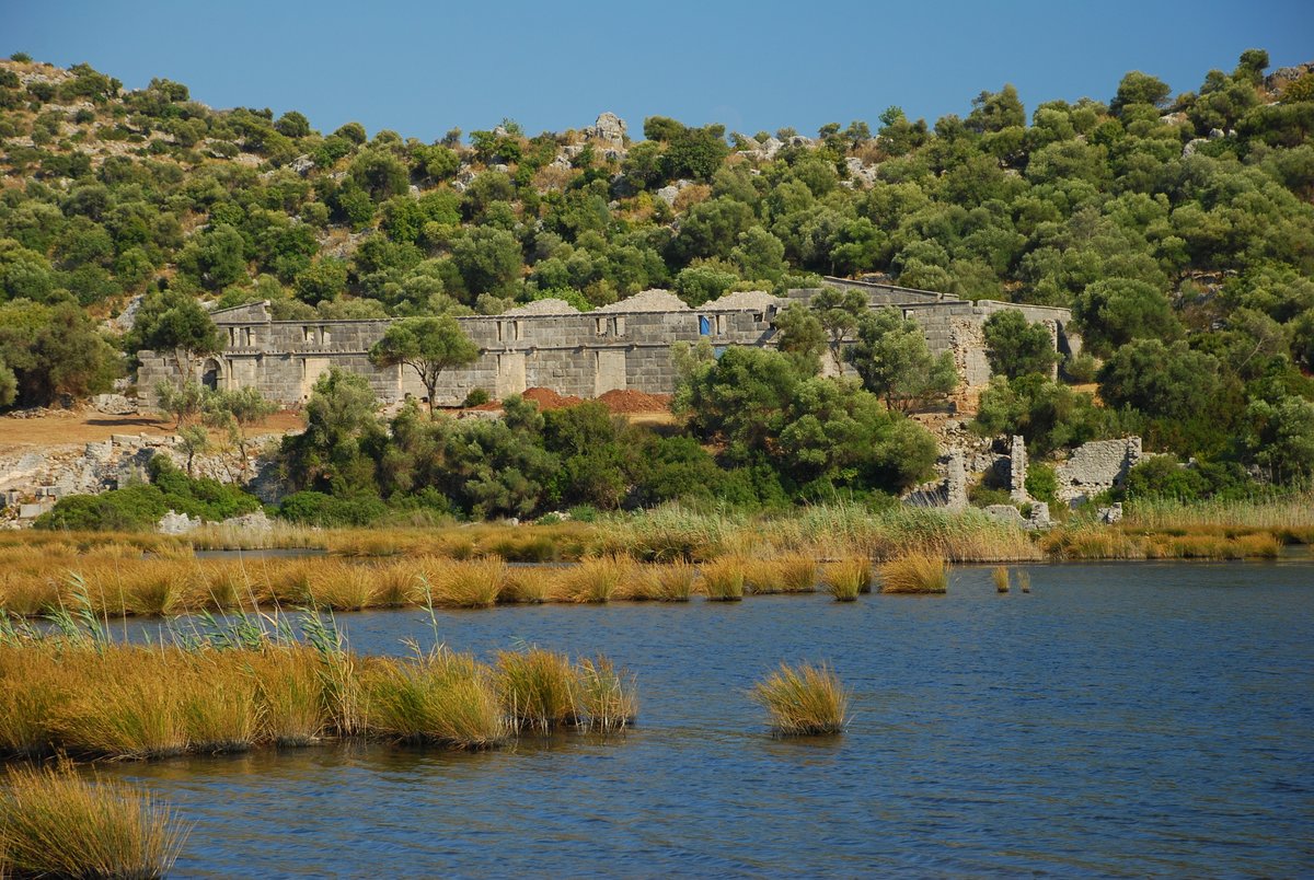
The marsh behind the beach leads to the Apollo temple at ‘Sura’ and is also home to many species of birds. Crossing a normal bridge at the other end of the bridge brings one to the port full of day boats sailing over Kekova’s submerged harbour front. Crossing the road and heading for the hillside brings one to the ancient port of Andriake, the most impressive ruin being the granary (granarium) built during and in honour of the Roman Emperor Hadrian. There are a Latin inscriptions and a bust of the Emperor and his wife Sabina who traveled in the region in 136 AD. Now this is the Museum of Lycian Studies and it is worth visiting it. The walk continues by the edge of the hillside following the aqueduct to the nymphaeum on the main road. 6hrs
From here there are regular buses to Kas or downtown into Demre (Myra and St. Nicholas Church).
Walk 4: Hoyran- Kapakli- Simena
A new dirt road leads down beside ‘Hoyran Wedre’, the marked path runs off the road tracing the ancient Roman trail zig-zagging down the hillside. Passing by the mosque through the village of Kapakli the road descends seawards on to the path and joins into the ‘Lycian Way’ long-distance walking path. Turn right there and carry on the Lycian Way to Simena.
Walk 5: Trysa-Davazlar-Halavza-Hoyran
This stunning track is about 8 kilometers and it takes about 5 hours to complete.
Trysa is one of the loveliest and most neglected sites in central Lycia. It is just 5 kilometers away from Hoyran. When you arrive at D400 Kas-Demre main road, turn right there, and after about 1-kilometer turn left and park. From here a dirt road starts, which is only suitable for tractors or four-wheel trucks. The walk is very easy. Follow the marked path with red and white colors on the zigzags and after 15 minutes you arrive in the Necropolis area, where you can see lots of tombs. There, turn left and carry on for about 15 minutes. Then you arrive at Acropolis, where the famous Heroon used to be. Now it is in Vienna and the rest of it, its cymation (A tone block with a decorative frieze) is still so impressive. You can carry on to the west and see the remains of the small Byzantine church, a temple, and the ruins of the houses. Here you can see almost all of the central Lycia, from Myra, Kekova, Simena, Hoyran, and Kyaneai.
The track from Trysa to Hoyran through Davazlar and Halavza is well signed and it is quite easy to reach Hoyran following the marked path with red and white colors.
Walk 6: Trysa-Sura
This stunning track is about 8 kilometers and it takes about 5 hours to complete.
Trysa is one of the loveliest and most neglected sites in central Lycia. It is just 5 kilometers away from Hoyran. When you arrive at D400 Kas-Demre main road, turn right there and after about 1-kilometer turnleft and park. From here a dirt road stars, which is only suitable for tractors or four-wheel trucks. The walk is very easy. Follow the red dots on the zigzags and after 15 minutes you arrive in the Necropolis area, where you can see lots of tombs. There, turn left and carry on about 15 minutes. Then you arrive at Acropolis, where the famous Heroon used to be. Now it is in Vienna and the rest of it, its cymation (A tone block with a decorative frieze) is still so impressive. You can carry on to the west and see the remains of the small Byzantine church, a temple, and the ruins of the houses. Here you can see almost all of the central Lycia, from Myra, Kekova, Simena, Hoyran, and Kyaneai.
Then you would come back to the necropolis and turn left there. Following the marked with red and white colors you will pass some old stone houses. The area and the houses are empty now, however, you might see lots of goats around.
After an hour of walking, you come to the main road, D400, and cross over and carry on the asphalt road going to the small village Cakalbayat. After 10 minutes turn left towards the old road and join the Lycian Way going to Sura.